Cahokia was the largest and most influential urban center of the Mississippian world, and its story explains how Native North America built dense settlements, ceremonial landscapes, and far-reaching exchange systems centuries before European contact. When people ask what Cahokia was, the most accurate answer is this: it was a planned political and religious center near present-day Collinsville, Illinois, occupied most intensively between about 1050 and 1350 CE, marked by monumental earthen mounds, a central plaza, specialized craft production, and trade connections that linked communities across much of eastern North America. I have worked through Cahokia scholarship and museum collections enough to know that the site is often reduced to a single superlative, usually “the largest pre-Columbian city north of Mexico.” That phrase is useful, but incomplete. Cahokia matters not just because it was big, but because it demonstrates how Mississippian societies organized labor, authority, ritual, agriculture, and exchange on a remarkable scale.
The term “Mississippian” refers to a broad cultural tradition that spread across the Midwest, South, and Southeast after around 800 CE, distinguished by intensive maize agriculture, platform mounds, shell-tempered pottery in many regions, and politically central places where leaders coordinated ceremonies and redistribution. Cahokia was not the only Mississippian center, but it was the earliest and most expansive example of what archaeologists call a complex chiefdom or, in some interpretations, an early city. Its influence reached outward through migration, imitation, pilgrimage, gift exchange, and the movement of prestige goods. Understanding Cahokia therefore helps answer larger questions: how did regional power work without writing? How were markets and exchange managed? Why did monumental building matter? And what can settlement archaeology reveal about political authority, everyday foodways, and social inequality?
Those questions matter because Cahokia changes public assumptions about North American history. In classrooms, I often see people surprised to learn that urban planning, mass construction, astronomy-aligned monuments, and continental exchange networks existed in the Mississippi Valley a thousand years ago. Cahokia’s residents reshaped their landscape with deliberate engineering. They built Monks Mound, the largest earthen structure in North America, organized neighborhoods around plazas and mound groups, and moved enormous volumes of soil using baskets and human labor. They also participated in exchange systems that brought marine shell from the Gulf Coast, copper from the western Great Lakes, chert from regional quarries, and symbolic motifs that circulated through what scholars often call the Southeastern Ceremonial Complex. To understand Cahokia is to understand that Indigenous societies created sophisticated regional systems on their own terms, with their own institutions, beliefs, and economic logics.
What Cahokia was and how it was organized
Cahokia emerged in the American Bottom floodplain near the Mississippi, Missouri, and Illinois river confluences, a location that gave it exceptional agricultural and transportation advantages. The most dramatic transformation occurred during the so-called Big Bang, roughly 1050 to 1100 CE, when population increased rapidly and construction accelerated. Archaeologists estimate that greater Cahokia may have housed between ten thousand and twenty thousand people at its height, though exact figures remain debated because population reconstructions depend on house counts, site boundaries, and occupation spans. Even at the conservative end, Cahokia was enormous by contemporary North American standards.
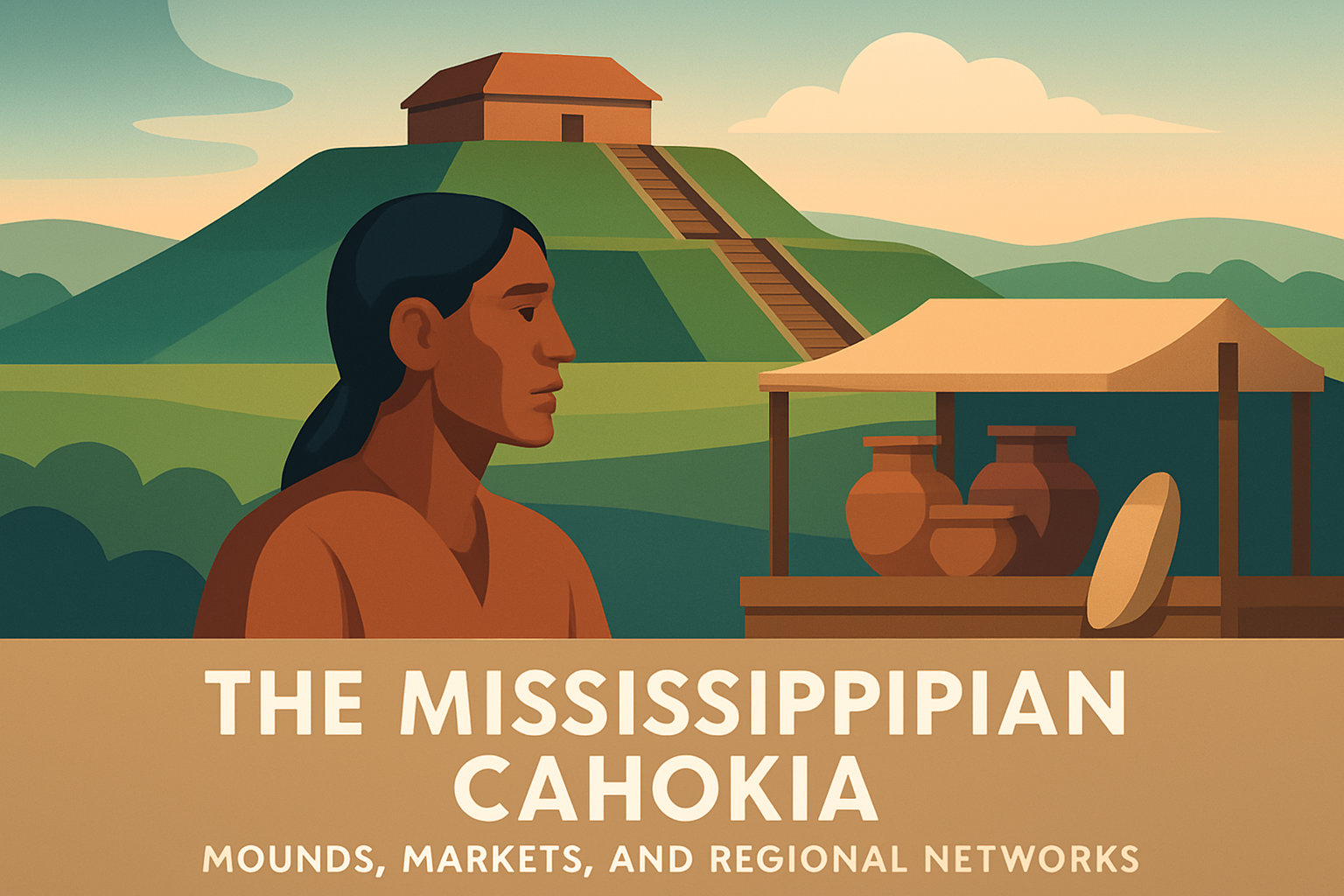
The site core included a vast central plaza and more than one hundred earthen mounds. Monks Mound dominated the landscape, rising in multiple terraces and likely supporting an important building, perhaps the residence or ceremonial headquarters of a paramount leader. Around it stood ridge-top and platform mounds that likely served mortuary, political, and ritual functions. Woodhenge circles made of large cedar posts appear to have marked solar alignments, helping structure ceremonial calendars. Residential districts spread outward, and outlying mound centers formed a larger political landscape rather than an isolated ceremonial precinct. This pattern tells us Cahokia was planned. It was not simply a village that grew larger over time; it was reorganized to express hierarchy, movement, and communal spectacle.
Its social organization was equally structured. Excavations show differences in house size, location, feasting remains, and burial treatment, all suggesting ranked status. Mound 72, for example, produced one of the best-known elite burial contexts at Cahokia, including shell bead deposits, sacrificial victims, and carefully arranged bodies. Interpretations of that mound have evolved as methods improved, but the core point remains: some individuals were treated in death in ways that reflected concentrated authority and symbolic power. Cahokia therefore was both a lived city and a ceremonial capital, where political legitimacy was reinforced by architecture, ritual performance, and visible control over labor.
Mounds as infrastructure, symbolism, and power
The mounds at Cahokia were not decorative piles of dirt. They were engineered architecture with political and practical functions. Archaeologists have documented different mound forms, including platform, conical, and ridge-top types, each associated with specific uses. Platform mounds elevated important structures above the surrounding landscape, making leadership physically visible. Conical mounds often had mortuary roles. Ridge-top mounds helped define processional space and plaza edges. Building them required organized labor, planning, and a reliable food surplus, which means mound construction itself was evidence of state-like coordination even if scholars debate that label.
In practical terms, mounds created durable civic space. Elevated buildings stayed above flood-prone ground, and terraces organized movement and visibility during ceremonies. In symbolic terms, mounds remade the natural floodplain into a sacred order. Across Mississippian cosmology, elevated places were linked to authority, ancestors, and connections between earthly and celestial realms. Cahokia’s builders materialized those ideas in earth. I find this point essential because it prevents a false split between religion and government. At Cahokia, the same mound could be a stage for ritual, a seat of leadership, and a statement about cosmic order.
Monks Mound is the clearest example. Covering roughly fourteen acres at its base and rising about one hundred feet, it is larger than many readers expect even after seeing photographs. Soil studies indicate construction in multiple episodes rather than a single campaign, and slope maintenance was an ongoing challenge. That detail matters because it shows Cahokia’s leaders were not merely building monuments; they were maintaining them, repairing erosion, and sustaining labor obligations over generations. Monumentality was a continuous process. The result was a built environment that communicated permanence, hierarchy, and communal identity to residents, visitors, and subordinate communities throughout the region.
Markets, exchange, and daily economic life
Did Cahokia have markets? The careful answer is that archaeologists see strong evidence for intensive exchange, craft specialization, and centralized redistribution, while the exact formality of marketplace institutions remains debated. Some scholars argue that the Grand Plaza and nearby activity areas could have hosted periodic markets where food, pottery, stone tools, basketry, and ritual items were exchanged. Others emphasize tribute, kin-based reciprocity, and elite-controlled redistribution rather than open-market behavior. In practice, Cahokia’s economy likely included all three. Large centers rarely function through a single exchange mode.
Daily economic life began with agriculture. Maize was the staple crop, supported by beans, squash, native seed plants, deer, fish, waterfowl, and gathered resources from wetlands and uplands. A city-scale population required dependable harvests and storage, and the American Bottom’s fertile soils helped provide that base. At the same time, specialized production became more visible. Craft workers produced pottery, stone tools, shell ornaments, and finely made ceremonial objects. Mill Creek chert hoes from southern Illinois are a useful example: they were quarried, shaped, and distributed widely, tying agricultural production to regional exchange. When I explain Cahokia to readers, I stress that food systems and craft systems were inseparable. The same networks that moved prestige goods also supported everyday farming and household survival.
| Economic element | What archaeologists find | What it suggests |
|---|---|---|
| Maize agriculture | Plant remains, storage pits, hoe production | Food surplus supported dense population and labor projects |
| Craft specialization | Shell beads, pottery, stone tools, copper working | Some households or districts focused on skilled production |
| Regional exchange | Marine shell, Great Lakes copper, nonlocal stone | Cahokia linked distant communities through trade and tribute |
| Public gathering spaces | Large plaza, access routes, clustered activity areas | Periodic markets or redistributive events likely occurred |
Exchange at Cahokia should not be imagined as a modern cash market. No coinage existed, and value was social as much as material. Goods moved through kin ties, political obligations, ceremonial gifting, and possibly regulated trading events. Prestige items could reinforce alliances. Everyday goods could circulate through reciprocal exchange between households and nearby settlements. This mixed economy is one reason Cahokia became such an effective regional hub: it could attract pilgrims, traders, craft producers, and dependent farming communities into overlapping networks rather than forcing all interaction into one rigid structure.
Regional networks and Cahokia’s wide influence
Cahokia’s regional networks extended far beyond the site core. Archaeologists trace its influence through artifact styles, settlement reorganization, ritual objects, and direct colony-like communities. The best-known example is the spread of Mississippian traits into places such as Aztalan in Wisconsin, Angel Mounds in Indiana, Moundville in Alabama, and Etowah in Georgia, though each developed its own local form rather than becoming a Cahokian copy. Influence worked through selective adoption. Communities borrowed mound-building practices, ceremonial symbols, pottery styles, and political ideas while adapting them to local histories and environments.
Material evidence supports these connections. Gulf Coast marine shell reached Cahokia and was turned into beads, cups, and ornaments. Copper from the Great Lakes circulated into ornamental and ceremonial use. Chert and other lithic materials moved along river corridors. Rivers mattered because they were North America’s major transportation infrastructure long before roads. A canoe-based network linking the Mississippi and its tributaries could move people, raw materials, and ideas with far greater efficiency than overland travel alone. Cahokia’s location near major confluences gave it the equivalent of a logistical advantage that port cities enjoy in later eras.
Cultural influence traveled with objects. Iconography associated with raptor imagery, chunkey stones, ceremonial weapon motifs, and sacred narratives appeared across broad areas. Scholars often discuss these patterns under the label Southeastern Ceremonial Complex, though that term can oversimplify diverse local traditions. Still, the pattern is real: elites and ritual specialists in multiple regions shared symbolic vocabularies that helped legitimize authority. Cahokia appears to have been one of the earliest major engines of that process. In effect, it functioned as both a metropolitan center and a sacred node in a wider interaction sphere, where regional networks connected economy, religion, and governance.
What archaeology reveals about people, belief, and decline
Cahokia is known through archaeology because it had no writing system in the alphabetic sense, so every conclusion depends on excavation, dating methods, environmental analysis, and comparison across sites. That evidence reveals daily life as well as leadership. House patterns show neighborhoods and rebuilding cycles. Faunal remains show varied diets and seasonal exploitation. Palynology and geoarchaeology track land-use change, flooding, and forest pressure. Bioarchaeology reveals health stress, workload differences, and social inequality. Taken together, these methods show a city that was dynamic and innovative but also vulnerable to strain.
Belief was built into the landscape. Woodhenge circles likely tracked solstices and equinoxes, helping align ceremony with agricultural time. Public rituals in plazas would have created shared spectacle and political cohesion. Feasting debris at some contexts suggests leaders used food and ceremony to consolidate support. This is familiar to archaeologists who study early complex societies worldwide: public ritual is not separate from political economy; it is one of its operating mechanisms. Cahokia followed that pattern in a distinctly Mississippian way, combining maize agriculture, sacred geography, ancestral authority, and theatrical monumentality.
Why did Cahokia decline after its peak? There is no single accepted cause, and serious interpretation requires caution. Population loss after the thirteenth century likely involved several factors: political instability, changing trade relationships, environmental stress, resource depletion, flooding, and the difficulty of sustaining centralized authority over a large population. Some neighborhoods were abandoned, defensive features appeared in parts of the broader region, and monumental construction slowed. Importantly, decline did not mean disappearance of Indigenous history. Descendant Native communities carried forward cultural traditions even as Cahokia’s urban form changed. The key lesson is balanced: Cahokia was neither a mysterious vanished civilization nor a failed experiment. It was a powerful Indigenous center whose history included innovation, adaptation, conflict, and transformation. For anyone studying North American archaeology, Cahokia remains essential because it proves that mounds, markets, and regional networks were not isolated phenomena. They were integrated systems that made one of the continent’s most remarkable cities possible.
The clearest takeaway from Cahokia is that urbanism in ancient North America took a form rooted in Indigenous institutions rather than Old World models. Cahokia combined monumental mounds, a productive farm economy, public ritual, and long-distance exchange into a coherent regional system. Its planners used earthworks to structure power, its residents sustained dense neighborhoods through maize agriculture and craft production, and its leaders drew distant communities into networks of trade, symbolism, and political affiliation. That combination is why Cahokia still anchors conversations about Mississippian society, complex chiefdoms, early cities, and pre-Columbian exchange.
It also offers a practical lesson for readers trying to understand the archaeological record. Large monuments do not stand alone. Behind every mound are labor systems, food surpluses, transport routes, ritual calendars, and social negotiations. Behind every traded shell bead or copper ornament is a network of rivers, alliances, and obligations. When you view Cahokia through that integrated lens, the site becomes more than a famous mound center. It becomes evidence of how communities coordinate scale, meaning, and movement across an entire region. That is the real significance of Cahokia’s mounds, markets, and regional networks.
If you want to go deeper, start with Cahokia Mounds State Historic Site, then compare it with places such as Moundville, Etowah, and Angel Mounds to see how Mississippian ideas changed across regions. Read archaeological syntheses, look closely at excavation reports, and pay attention to how evidence is interpreted rather than memorizing a few headline facts. Cahokia rewards that effort. The more closely you study it, the more clearly you see one of North America’s great Indigenous centers on its own terms.
Frequently Asked Questions
What was Cahokia, and why is it so important in North American history?
Cahokia was the largest and most influential urban center of the Mississippian world, located near present-day Collinsville, Illinois, across from modern St. Louis. At its height, especially between about 1050 and 1350 CE, it was far more than a village or isolated ceremonial site. It was a carefully organized political and religious center with monumental earthen mounds, broad public plazas, neighborhoods, specialized activity areas, and a large surrounding population connected to the city’s core. Its scale alone makes it remarkable, but its importance goes beyond size. Cahokia demonstrates that Native societies in North America developed dense settlements, large public works, complex leadership structures, and extensive exchange systems centuries before European contact.
Archaeologists view Cahokia as a key example of early urbanism in North America because the site was intentionally planned and built. The city included Monks Mound, the largest prehistoric earthen structure north of Mexico, along with dozens of other platform and conical mounds that shaped a ceremonial landscape visible across the region. These constructions required labor coordination, engineering knowledge, and social organization on a massive scale. Cahokia also influenced communities far beyond its immediate boundaries through trade, ritual practices, artistic styles, and political relationships. For that reason, Cahokia is central to understanding how Mississippian societies created regional networks that linked people, goods, and ideas over long distances.
What were the mounds at Cahokia used for?
The mounds at Cahokia were not simply piles of earth or burial hills with a single purpose. They formed a monumental landscape that served political, religious, social, and commemorative functions. Many were platform mounds, built with flat tops that supported important structures such as elite residences, council buildings, temples, or ritual spaces. The largest of these, Monks Mound, dominated the site and likely held buildings connected to high-status leadership and ceremonial authority. Other mounds may have marked places where public events, feasts, governance, and ritual performances took place, helping organize the city physically and symbolically.
Some mounds also had mortuary importance, with burials and commemorative activity tied to lineage, status, and sacred meanings. Together with open plazas, causeways, and aligned features such as woodhenges, the mounds created a ceremonial environment that expressed order, power, and cosmological beliefs. Their placement was not random. Cahokia’s builders reshaped the landscape in deliberate ways, creating spaces where political authority and religious meaning reinforced one another. The mounds therefore tell us that Cahokia was both a seat of leadership and a sacred center, where built space itself communicated hierarchy, identity, and connection to the wider Mississippian world.
Did Cahokia have markets and long-distance trade networks?
Yes, Cahokia was deeply involved in regional exchange systems, and many scholars believe market-like activity played an important role in daily and ceremonial life. While the exact form of exchange at Cahokia is still debated, the archaeological evidence clearly shows that goods, raw materials, and crafted objects moved into and out of the city across substantial distances. Items associated with Mississippian exchange networks include marine shell from the Gulf Coast, copper from the Great Lakes region, exotic stone, mica, and high-quality chert used for tools. These materials did not arrive by accident. Their presence points to organized connections linking Cahokia to communities across broad parts of eastern North America.
Cahokia itself was also a center of production and redistribution. Artisans worked shell, stone, clay, and other materials, producing objects that likely carried both economic and symbolic value. Its large population, central location near major river systems, and political influence would have made it a natural hub for the movement of food, craft goods, and prestige items. Whether these exchanges occurred in formal marketplaces, through tribute, reciprocal alliances, pilgrimage traffic, or elite-controlled distribution, the result was the same: Cahokia stood at the heart of a regional network. That network helped spread styles, religious symbols, technologies, and social practices, showing that Mississippian societies were connected through sophisticated systems of interaction rather than existing as isolated local communities.
How was Cahokia able to support such a large population?
Cahokia’s growth depended on a combination of environmental advantages, agricultural productivity, and social organization. The site was positioned in the fertile American Bottom, a rich floodplain near the Mississippi, Missouri, and Illinois river systems. This location provided excellent soils, access to water, transportation routes, fish and wildlife resources, and easy movement of people and goods. Most importantly, Cahokia was sustained by intensive maize agriculture, which allowed communities to produce large surpluses. Corn, along with beans, squash, gathered plants, hunting, and fishing, helped support both the city’s residents and the labor needed for mound construction and public events.
But food alone does not create a major center. Cahokia also required coordinated leadership capable of organizing work, managing ceremonial calendars, and integrating surrounding communities into a broader political and ritual system. Feasting, tribute, seasonal gatherings, and shared religious practices may all have helped bind people to the center. Residential districts and nearby farmsteads likely formed part of a larger settlement network that fed and sustained the urban core. In other words, Cahokia was supported by both an agricultural landscape and a social landscape. Its success came from combining productive land, strategic geography, and institutions that could mobilize labor and maintain regional influence over generations.
Why did Cahokia decline, and what happened after its peak?
Cahokia’s decline was not caused by a single dramatic event, and that is one reason the topic remains so important to archaeologists. After its peak, the city gradually lost population and political prominence, with major changes becoming visible after the thirteenth century. Researchers have proposed several interacting causes, including environmental stress, flooding or changing water conditions, deforestation, pressure on local resources, political instability, social conflict, and the challenges of maintaining a very large ceremonial center over time. Climate fluctuations may also have affected farming reliability, which would have placed strain on a society dependent on agricultural surplus and coordinated labor.
Even so, decline does not mean disappearance in a simplistic sense. People continued to live in the broader region, and Mississippian traditions persisted in many communities across eastern North America. Cahokia’s influence outlasted the city’s peak through artistic motifs, ceremonial practices, settlement patterns, and political models that spread well beyond the American Bottom. Today, archaeologists understand Cahokia not as a mystery civilization that suddenly vanished, but as a dynamic Native center that rose, transformed, and changed over time. Its history remains essential for understanding Indigenous achievement, resilience, and the development of regional networks in pre-contact North America.