In an increasingly interconnected and technology-driven world, understanding latitude and longitude coordinates is more relevant than ever. Latitude and longitude are the backbone of our modern navigation systems, offering precise geographic positioning that helps us find any location on Earth. These coordinates are not only crucial for driving directions on a GPS device but also play a vital role in various fields such as aviation, shipping, meteorology, and even geocaching, a popular outdoor recreational activity. Comprehending these fundamental geographical concepts enables individuals to appreciate and utilize the connectivity of our world.
Latitude and longitude are part of a coordinate system that segments the Earth into a grid for pinning down exact locations. Latitude measures how far north or south a point is from the equator, whereas longitude measures how far east or west a place is from the Prime Meridian. These coordinates are expressed in degrees, with latitude ranging from 0° at the Equator to 90° at the poles, and longitude spanning 0° at the Prime Meridian to 180° east or west. Besides offering precise measurements for navigation, knowing how to use latitude and longitude can enhance your understanding of global geography, aid in location-based data analysis, and even boost your travel experiences.
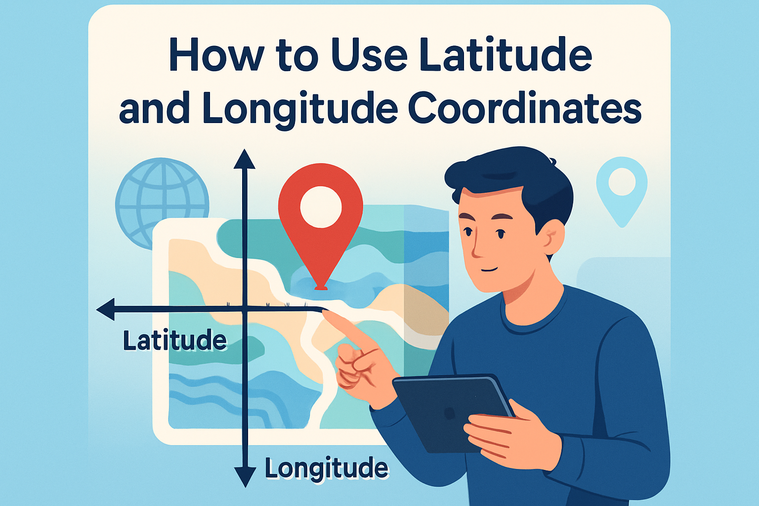
Understanding Latitude and Longitude
The globe is divided by two primary sets of lines: the parallels of latitude and the meridians of longitude. These imaginary lines help us ascertain the geographic location of any point on Earth. Latitude lines run horizontally, circling the Earth parallel to the equator. The equator itself is the baseline for latitude, marked at 0°. As you move towards the poles, latitude numbers increase up to 90° north or south.
Longitude lines, on the other hand, run vertically from pole to pole, converging at the polar areas. The Prime Meridian, passing through the Greenwich Observatory in London, serves as the starting point for measuring longitude. It is marked at 0°, with measurements extending to 180° east or west. These lines form a grid system used globally to specify any location, a system known as the Geographic Coordinate System (GCS).
How Latitude and Longitude Coordinates Work with GPS
The Global Positioning System (GPS) is a network of satellites that transmits precise signals, allowing GPS receivers to determine exact locations on Earth using latitude and longitude. By processing signals from at least four satellites, a GPS can calculate a location’s precise position, speed, and time. This triangulation method is pivotal for navigation applications.
For instance, when you use a GPS for driving directions, the device translates your current latitude and longitude into a map location, plotting a course to your intended destination by continually adjusting based on your real-time coordinates. GPS is an essential tool for an array of industries, from transportation and logistics to outdoor recreation and emergency response services.
Real-World Application: Aviation
Aviation relies heavily on latitude and longitude for navigational purposes. Pilots use these coordinates to map out flight paths, ensuring that flights remain on course and reach their destinations safely and efficiently. Flight planning involves setting waypoints – defined latitude and longitude spots – that guide planes along predetermined routes.
For example, pilots navigating between New York City (approximately 40.7128° N, 74.0060° W) and London (approximately 51.5074° N, 0.1278° W) reference specific latitude and longitude coordinates to maintain an accurate flight path. This becomes crucial, especially when flying over vast stretches of ocean with no visual landmarks.
Using Latitude and Longitude in Cartography
Cartography, the science of map-making, uses latitude and longitude to represent the spherical Earth on a flat surface. Different map projections incorporate these coordinates to balance distortions in area, shape, distance, or direction. Popular projections include the Mercator, which preserves angles for navigation but misrepresents size near the poles, and the Robinson, which provides a more visually appealing balance of size and shape distortions.
For instance, when mapping geopolitical boundaries or plotting topographic features, cartographers rely on accurate latitude and longitude data to ensure that maps are both precise and user-friendly.
Latitude and Longitude in Weather Forecasting
Meteorologists use latitude and longitude to track weather systems and model climate patterns. By pinpointing the coordinates of a storm, they can predict its trajectory and potential impact on regions in its path. Advanced computer models simulate weather conditions, often relying on a grid defined by latitude and longitude, to provide forecasts.
Consider a hurricane forming in the Atlantic Ocean; meteorologists observe its coordinates (such as 20.0° N, 60.0° W) to monitor its movement and issue timely warnings to affected areas. The precise use of latitude and longitude is crucial for predicting and preparing for severe weather events.
Latitude, Longitude, and Geocaching
Geocaching blends outdoor adventure with technology, requiring participants to use latitude and longitude coordinates to find hidden containers, or “caches.” This digital scavenger hunt uses GPS-enabled devices to locate caches, which range in size and difficulty, scattered globally.
Participants use a GPS device or smartphone app to navigate to coordinates such as 47.6205° N, 122.3493° W, which might lead them to a cleverly hidden cache in a Seattle park. This activity not only promotes exploration but also enhances participants’ understanding of spatial awareness and coordinate systems.
Benefits of Learning Latitude and Longitude
The ability to understand and apply latitude and longitude extends beyond mere navigation; it opens up a world of discovery and analysis. By mastering these coordinates, individuals can engage more meaningfully with spatial data, participate in activities like geocaching, or even enhance their travel adventures with a deeper geographical context.
Moreover, many industries require a fundamental knowledge of these coordinates. Professionals in fields such as logistics, environmental science, urban planning, and tourism benefit from the precision and universality that latitude and longitude provide. Whether mapping out complex supply routes or assessing environmental impact, these coordinates are a pivotal tool in decision-making processes.
Practical Tips for Using Latitude and Longitude
For those new to using latitude and longitude, here are a few practical guidelines:
- Understand the format: Latitude and longitude can be expressed in degrees, minutes, and seconds (DMS) or decimal degrees (DD). For instance, New York City can be denoted as 40°42’46″N, 74°00’21″W (DMS) or 40.7128° N, 74.0060° W (DD).
- Accurate input is crucial: When using navigation devices or entering coordinates into applications, ensure precision by double-checking your data entry to avoid navigation errors.
- Utilize mapping tools: Platforms such as Google Maps or specialized apps like GPS Tracks allow users to input coordinates and retrieve the corresponding map locations, facilitating easier navigation and exploration.
Summary and Next Steps
Latitude and longitude coordinates serve as the universal language of navigation, offering a systematic way to identify locations with high precision. Whether you are planning a cross-country road trip, coding geographic data, or participating in outdoor adventures like geocaching, these coordinates play an indispensable role in the functioning of our world. Understanding how to read and use these coordinates can enrich your geographical knowledge, improve navigational skills, and even advance career prospects in various fields.
We encourage you to explore further resources and tools that offer practical applications of latitude and longitude. Delve into map-making tutorials, practice with GPS applications, or join a local geocaching group to enhance your skills. Taking the step to master these coordinates will not only provide immediate benefits but also equip you with a lifelong skill set that fosters exploration and connectivity.
Frequently Asked Questions
1. What are latitude and longitude coordinates, and why are they important?
Latitude and longitude are a system of lines used to identify specific locations on Earth’s surface. Latitude lines run horizontally around the globe and measure the distance north or south of the Equator, which itself is zero degrees latitude. These lines are parallel to each other, with the North Pole at 90 degrees North and the South Pole at 90 degrees South. Longitude lines, on the other hand, run vertically from the North Pole to the South Pole, measuring the distance east or west of the Prime Meridian, which is set at zero degrees longitude and runs through Greenwich, England. The maximum extent for longitude is 180 degrees in either direction, east or west.
The coordinates are crucial because they provide a universal language for location mapping and navigation. By giving a specific latitude and longitude, you can pinpoint virtually any location on Earth with precision. This system is foundational for modern GPS devices, enabling them to guide you to your destination seamlessly. Beyond everyday applications like driving directions, these coordinates are vital in numerous fields. For instance, in aviation and shipping, they ensure safe and accurate passage over vast distances. Meteorologists use them to track weather patterns and forecasts, while geocaching enthusiasts employ them to embark on treasure hunts in the great outdoors.
2. How do I read and interpret latitude and longitude coordinates?
Reading latitude and longitude coordinates is relatively straightforward when you understand the format. Coordinates are usually presented as two sets of numbers, often separated by a comma. The first number is the latitude, which can be either positive or negative. Positive latitude indicates a location in the Northern Hemisphere, while negative latitude indicates the Southern Hemisphere. The second number is the longitude and follows a similar rule: positive values are east of the Prime Meridian, and negative values are west.
For example, the coordinates 40.7128° N, 74.0060° W denote a point at approximately 40.7128 degrees north of the Equator and 74.0060 degrees west of the Prime Meridian. This particular location is actually New York City. It’s important to note that latitude is always given before longitude. Coordinates might also be represented in degrees, minutes, and seconds, instead of decimal degrees. In this format, New York City would appear as 40°42’51” N, 74°00’21” W.
3. What tools or methods can I use to find latitude and longitude for a specific location?
Today’s technology offers a myriad of tools for determining latitude and longitude coordinates. Perhaps the most common is a Global Positioning System (GPS) device, which uses signals from satellites to determine your precise location down to a matter of feet. Most smartphones are equipped with built-in GPS capabilities and can provide coordinates via their maps or navigation apps. Popular apps like Google Maps or Apple Maps allow you to search for a location, click on a point of interest, and view its specific latitude and longitude.
If you prefer desktop options, websites like Google Maps or Bing Maps can easily provide coordinates for any searched location. Simply right-click the point on the map for Google, or use the map-specific options on Bing, and you’ll receive the pertinent information. For those interested in historical or less tech-driven methods, topographic maps used by cartographers also provide latitude and longitude, although reading them requires a bit more skill and practice. Additionally, geocaching websites and apps provide coordinates as part of their treasure maps, allowing outdoor enthusiasts to find caches hidden across the globe.
4. Can I input latitude and longitude coordinates into a GPS device or mapping software to find a location?
Absolutely, inputting latitude and longitude directly into a GPS device or mapping software is a powerful way to navigate to a specific location. Most modern GPS units have a feature that allows users to manually enter coordinates. This is particularly useful when navigating to remote areas where an address might not be available, such as in wilderness regions or at sea. To do this, simply locate the “coordinates” or “waypoint” function in your GPS menu. Input the coordinates in the appropriate format, ensuring the accuracy of both latitude and longitude values, and then save the location. Your GPS will often provide options to start navigation, view it on a map, or even set it as a waypoint for ongoing activities.
Similarly, mapping software like Google Maps also allows users to input coordinates directly into the search bar. By entering the latitude and longitude with a comma separating them, you can find the exact spot on the map and receive directions from your current location. It’s worth mentioning that when entering these coordinates, you should be mindful of using the correct format, whether it be decimal degrees (e.g., 40.7128, -74.0060) or degrees, minutes, and seconds (e.g., 40°42’51″N 74°00’21″W), as some systems may require one or the other.
5. How do latitude and longitude coordinates affect everyday activities and industries?
Latitude and longitude have a profound impact on numerous aspects of daily life and industries. From the perspective of everyday conveniences, these coordinates enable individuals to utilize GPS technology for navigation, providing efficient and accurate travel routes in vehicles or on foot. Whether you’re driving to a new destination, using ride-sharing apps, or seeking local attractions, the precision offered by coordinates ensures you get to where you need to go promptly and safely.
In the world of commerce and industry, latitude and longitude are indispensable. The aviation industry relies heavily on these coordinates for flight planning and air traffic control, ensuring all flights follow safe routes. Shipping industries use them for plotting courses across the oceans, maintaining the timely and efficient transport of goods worldwide. Meteorologists depend on coordinates to map weather patterns and climate data, contributing to better forecasting and preparedness. Even emergency services leverage this geographic information for efficient and rapid response in crisis situations. Lastly, this coordinate system supports the burgeoning field of geospatial science, including applications in surveying, environmental studies, and smart city development. Understanding and utilizing latitude and longitude is thus integral to both modern innovation and the everyday smooth operation of countless activities and sectors.