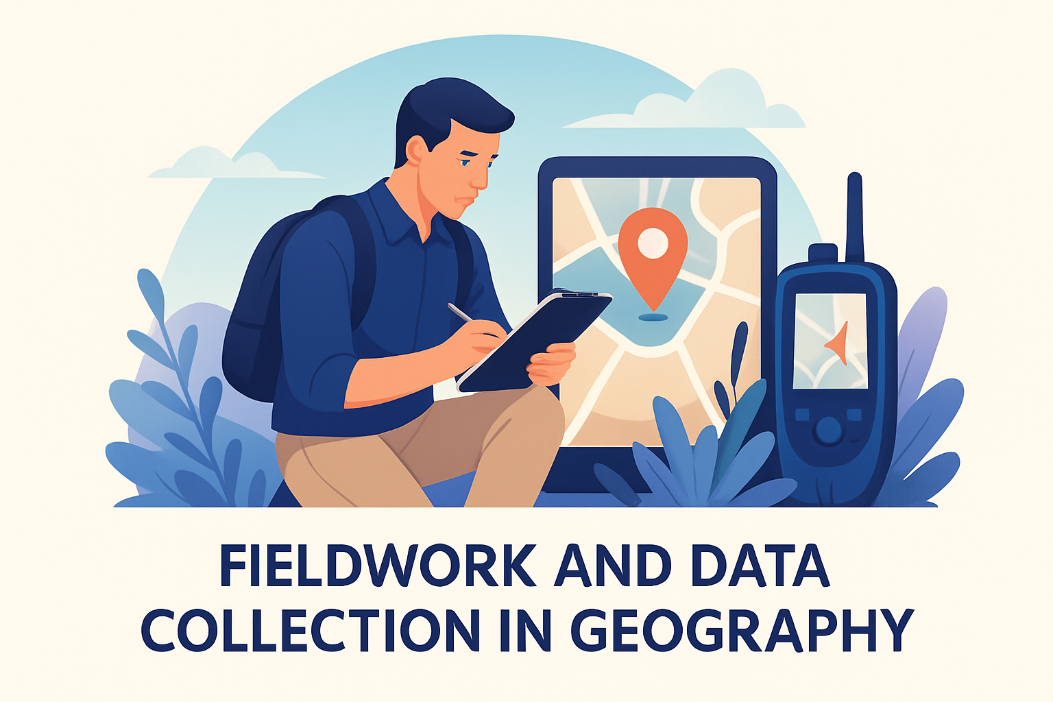
Fieldwork and data collection are fundamental components of geographical studies, providing critical insights into the spatial and physical characteristics of the Earth. These processes involve the direct gathering of information from the natural environment or through interactive engagements with communities and cultures. Fieldwork and data collection encompass a variety of methods such as surveys, observations, interviews, and the use of technological tools to gather geographic information. Understanding these methods’ significance is essential for geographers to analyze spatial patterns and environmental changes. These insights can inform decisions in urban planning, resource management, environmental conservation, and policy-making. Engaging with the environment through fieldwork allows geographers to connect theory with practice, resulting in a more comprehensive understanding of the world’s dynamic nature.
Methods of Fieldwork in Geography
Geographical fieldwork employs various methods to collect valuable data. Each technique is chosen based on the research objectives and the type of data needed. One common method is observation, where geographers systematically record information about the environment, such as land forms, vegetation types, or weather conditions. For instance, during a study on coastal erosion, geographers might observe and document changes in shoreline positions over time. Observational fieldwork is essential because it captures real-time changes in the environment, providing a factual basis for future analytical processes.
Another crucial fieldwork method is conducting interviews and surveys, particularly when investigating human geography topics. These interactions allow researchers to gather qualitative data about human experiences, behaviors, and perceptions. For example, when examining urban development, surveys can capture residents’ views on the impact of new infrastructure on their lives. Interviews and surveys offer in-depth insights into the societal dynamics and interactions with the geographical space, thus enriching the overall understanding of a region’s human geography.
Geographers also rely on technological tools such as Global Positioning Systems (GPS) and Geographic Information Systems (GIS) in fieldwork. These tools facilitate precise data collection and spatial analysis. In a study on deforestation, GIS technology can help map out areas of forest loss, overlaying this with other data such as rainfall patterns to understand the causes and impacts. The integration of technology not only enhances the accuracy of geographic data but also allows for more sophisticated analyses and predictions.
Real-World Applications of Geographical Data Collection
Fieldwork data collection is essential for practical applications in various sectors, such as urban planning, environmental management, and disaster preparedness. In urban planning, spatial data collected from fieldwork helps planners design cities that are efficient and sustainable. By analyzing land use patterns, population densities, and transport networks, planners can optimize urban spaces to improve living conditions and resource allocation. A notable example is the redevelopment of Curitiba, Brazil, where fieldwork data guided the creation of an integrated public transportation system and green spaces, significantly improving urban life quality.
Environmental management greatly benefits from geographical data collection. Accurate field data enables effective monitoring and conservation of natural resources. For example, in managing water resources, fieldwork data such as river flow rates and water quality measurements are crucial for developing sustainable water use strategies. Such data can help identify pollution sources, manage irrigation needs, and prepare for drought conditions, ensuring the sustainability of water supplies.
- Urban Planning: Guides efficient city design
- Environmental Management: Aids resource conservation
- Disaster Preparedness: Improves response strategies
Disaster preparedness and response are significantly enhanced through fieldwork data collection. Accurate and timely data allow governments and organizations to design effective strategies to mitigate and respond to natural disasters such as earthquakes, floods, and hurricanes. By analyzing geographical patterns and vulnerabilities, they can develop better early warning systems and prepare emergency response plans. The collection and analysis of temporal and spatial data during fieldwork enable planners and responders to anticipate impacts and mobilize resources to protect vulnerable communities.
Challenges in Fieldwork and Data Collection
While fieldwork provides invaluable data, it also comes with challenges and limitations. Geographers must often operate in difficult or remote environments, affecting the feasibility and safety of data collection efforts. For example, accessing mountainous terrains or dense forests can be physically demanding and dangerous, limiting the geographic scope of research. Weather conditions, political instabilities, and logistical constraints further complicate fieldwork activities.
Data collection itself can be challenging due to technological and methodological issues. Technological tools like GPS might fail in unfavorable conditions, such as dense urban areas where satellite signals are obstructed. Moreover, obtaining accurate and unbiased data from surveys and interviews can be difficult. Respondents may provide socially desirable answers or lack sufficient knowledge to provide reliable information. Researchers need to design their methodologies carefully, employing strategies such as multiple data sources and validation techniques to ensure reliability and accuracy.
Data analysis poses another challenge, particularly dealing with large volumes of data collected from diverse sources. Integrating and interpreting this data requires expertise in data management and geographic information systems. Researchers must be adept at using statistical and analytical tools to draw meaningful conclusions from complex datasets. Furthermore, ensuring data privacy and ethical considerations while gathering sensitive information remains a priority, requiring rigorous adherence to research ethics and guidelines.
Technological Advancements in Geographical Data Collection
The advent of new technologies has significantly advanced the capabilities of geographical data collection. Drones, or unmanned aerial vehicles, are increasingly used for fieldwork, allowing geographers to access and survey areas that were previously difficult or impossible to study. Equipped with cameras and sensors, drones can capture high-resolution images and gather data over large geographic areas quickly and efficiently. In agricultural studies, drones can assess crop health, monitor growth patterns, and detect issues such as pest infestations, enhancing farming practices through informed decision-making.
Satellite technologies also play a pivotal role in advancing geographical data collection. Remote sensing satellites provide a global perspective on environmental changes, offering continuous and comprehensive data on land cover, climate patterns, and human activity. The Landsat program, for example, has been crucial in monitoring deforestation, urban growth, and disaster impacts. This technological capability enables researchers to analyze temporal changes and predict future trends, contributing to more effective environmental management and urban planning.
Big data and machine learning techniques offer new avenues for processing and analyzing complex geographical datasets. By leveraging these technologies, geographers can identify patterns and relationships within large datasets that are beyond traditional analysis’s scope. For example, machine learning algorithms can predict urban heat island effects by analyzing temperature, land use, and vegetation cover data. These predictions allow city planners to develop strategies to mitigate heat-related impacts, improving urban living conditions.
The Future of Fieldwork in Geography
The future of fieldwork in geography promises exciting developments as technology continues to evolve. Virtual and augmented reality offer new possibilities for fieldwork, enabling researchers to simulate environments or overlay digital information onto physical landscapes. This can enhance educational experiences and training by allowing students and researchers to interact with environments in immersive, safe settings.
Collaborative fieldwork efforts are also expected to increase, leveraging the power of community participation in data collection and analysis. Citizen science projects, where non-professionals contribute to scientific research, can significantly expand data collection efforts and engage communities in the scientific process. For instance, members of the public can assist in biodiversity studies by submitting observations of local wildlife, enriching datasets and fostering greater environmental awareness.
As fieldwork methodologies evolve, ethical considerations will remain critical, particularly concerning data privacy and consent. Geographers must navigate these issues carefully, ensuring transparent communication and respect for individuals’ rights in all research activities. Overall, the continuous integration of technology, community involvement, and ethical practices will shape the future landscape of fieldwork and data collection in geography, enhancing our understanding and management of the Earth’s diverse geography.
Summary and Next Steps
Fieldwork and data collection are indispensable in geography, offering essential insights into spatial patterns and environmental dynamics. Through methods such as observation, interviews, technological tools, and collaboration with communities, geographers gather valuable data that informs urban planning, resource management, disaster preparedness, and environmental conservation. Real-world examples, like Curitiba’s urban redevelopment and global disaster response strategies, illustrate the practical applications and benefits of field data.
The advancement of technology further empowers geographical data collection, with innovations like drones, satellite imaging, and machine learning enhancing the precision and scope of fieldwork. Despite challenges such as logistical constraints and data accuracy issues, geographers continuously strive to improve methodologies and integrate ethical practices, ensuring reliable and respectful research processes.
To engage further with geographical fieldwork, consider participating in citizen science projects or exploring the use of digital tools like GIS for personal projects. These steps can provide firsthand experience and contribute to broader scientific knowledge, enriching our understanding and management of the world’s geography. Whether a professional geographer or an enthusiastic learner, actively engaging in fieldwork and data collection promises a deeper appreciation of the intricate and ever-changing geographic dimensions of our planet.
Frequently Asked Questions
1. What is the importance of fieldwork and data collection in geography?
Fieldwork and data collection in geography are crucial because they allow geographers to gain firsthand experience and insights into the natural and human environments they study. By collecting data directly from the source, researchers can analyze real-world conditions and identify patterns and relationships that might not be evident through other means. Fieldwork enables geographers to observe natural landscapes, weather patterns, urban development, and cultural practices in situ, providing a deeper understanding of spatial dynamics and environmental processes.
Furthermore, fieldwork often leads to new discoveries and supports the verification of theoretical models or hypotheses. For instance, geographers might use fieldwork to validate remote sensing data or to check the accuracy of maps. This hands-on approach enhances critical thinking and analytical skills, making it an indispensable aspect of geographical education and research. By engaging with local communities and environments, geographers can also promote awareness and sustainable development practices.
2. How do geographers use surveys in fieldwork for data collection?
Surveys are a common method used by geographers in fieldwork to collect quantitative and qualitative data from individuals or groups. These surveys can take various forms, such as questionnaires or structured interviews, and are designed to gather information on topics ranging from environmental issues to socio-economic conditions. Conducting surveys in the field allows geographers to capture the opinions, behaviors, and experiences of people in specific locations, providing valuable insights that inform geographic analysis.
Surveys can be administered in person, by phone, or online, depending on the research objectives and available resources. The data collected through surveys can be used to draw conclusions about the population as a whole or to compare different demographic groups. For example, a geographer studying urban development might use surveys to understand residents’ perceptions of new infrastructure projects. Aggregating survey results helps in identifying trends and making data-driven decisions in planning and policy-making.
3. What role do observations play in the fieldwork process?
Observations are a fundamental aspect of fieldwork in geography, allowing researchers to gather data by directly witnessing and recording events, processes, and behaviors as they occur in the natural or human environment. Through systematic observations, geographers can document physical phenomena, such as landforms, climate variations, vegetation patterns, and human activities, providing essential context for their studies.
Conducting observations involves carefully noting details such as time, location, and environmental conditions, often using tools like field notes, sketches, photographs, or video recordings. This method is particularly useful for understanding dynamic processes or structures that are difficult to quantify, and it often complements other data collection techniques like surveys or interviews. For instance, a geographer might use observations to track changes in a river’s course over time due to erosion, or to study how pedestrians navigate urban spaces.
4. How are technological tools used in geographic fieldwork and data collection?
Technological tools play a vital role in modern geographic fieldwork and data collection by enhancing accuracy, efficiency, and the breadth of data that can be obtained. Technologies such as Geographic Information Systems (GIS), Global Positioning Systems (GPS), satellite imagery, and remote sensing are commonly used to collect, analyze, and visualize spatial data. These tools allow geographers to map and model land use, track changes over time, and analyze spatial patterns with precision.
For example, GPS devices enable researchers to record the exact location of data collection points, which is critical for creating accurate maps and spatial analyses. Meanwhile, GIS software helps in integrating different types of data, such as topographic maps, demographic information, and environmental data, to conduct multi-layered analyses. Drones and unmanned aerial vehicles (UAVs) are also increasingly used to capture high-resolution imagery over large areas, providing detailed insights into landscape features and ecological conditions.
5. What challenges might geographers face during fieldwork and data collection?
Geographers often encounter a range of challenges during fieldwork and data collection, which can impact the study’s effectiveness and outcomes. One major challenge is accessibility; some study sites may be difficult to reach due to rugged terrain, remote locations, or adverse weather conditions. Such factors can complicate logistical planning and may require specialized equipment or permits to overcome.
Additionally, researchers must be mindful of ethical considerations, especially when working with human subjects or sensitive environments. This includes obtaining informed consent, protecting participants’ privacy, and ensuring that data collection practices comply with ethical standards. Language barriers, cultural differences, and socio-political contexts can also pose challenges when conducting interviews or surveys within diverse communities.
Another common issue is the reliability and validity of data, as fieldwork may involve subjective observations or responses that are influenced by various biases. Geographers must design robust methodologies to minimize these biases and ensure the reproducibility of their findings. By navigating these challenges thoughtfully, geographers can enhance the quality and impact of their research, contributing valuable knowledge to the field.