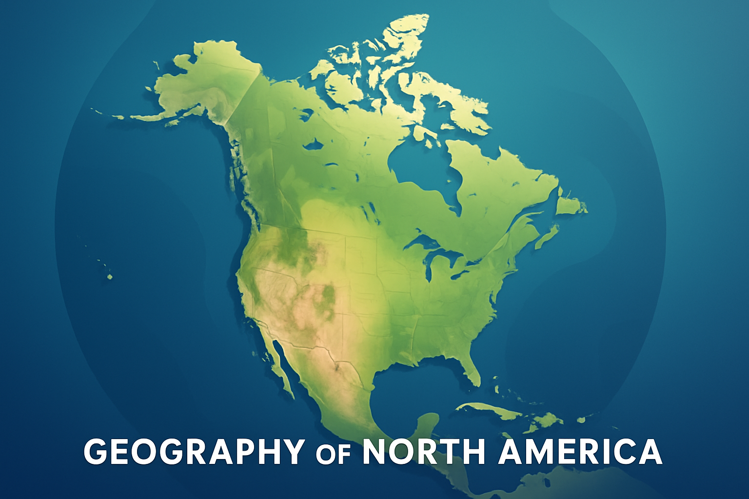
North America stands as a continent of substantial diversity and complexity, both in its geography and cultural mosaics. Encompassing an area of approximately 24.71 million square kilometers, it is the third-largest continent, following Asia and Africa, and includes countries as varied as the United States, Canada, Mexico, and several others spread across the Caribbean to Central American regions. Its vast landscapes are characterized by mountain ranges, extensive plains, arid deserts, and vibrant ecosystems that make it one of the most fascinating studies in geography. Understanding the geography of North America is an essential part of appreciating its role in global ecology, economy, and culture, making it a significant area of study not only for geographers but also for enthusiasts who seek to comprehend how land shapes life. The geographical distinctions within the continent provide insight into regional climate patterns, human settlement activity, natural resources distribution, and much more. Unveiling the geographic elements that constitute North America can help one appreciate the complex interplay between the natural environment and human activities through centuries of habitation and exploration.
Mountain Ranges and Their Impact
Mountain ranges have significantly influenced both the physical terrain and the climatic conditions of North America. The Rockies, one of the continent’s most prominent mountain ranges, stretch over 4,800 kilometers from the northernmost parts of British Columbia in Canada to New Mexico in the United States. This colossal range acts as a climate barrier, affecting weather patterns by impacting precipitation distribution. For instance, moisture-laden winds from the Pacific Ocean are cooled and condensed as they ascend the Rockies, resulting in ample rainfall on the western slopes. Consequently, the eastern side, known as the rain shadow region, experiences drier conditions, often contributing to desert biomes such as the Great Basin. Similarly, the Appalachian Mountains, though not as imposing as the Rockies, play a crucial role in influencing local climates and providing rich biodiversity. This topographical divide reinforces climatic conditions favorable for diverse ecosystems.
The Sierra Nevada mountains in the western United States offer another real-world example of how mountain ranges influence not only the weather but also economic activities; their snowpack is vital for California’s water supply, feeding rivers and reservoirs that support agriculture and urban consumption. Historically, these mountains presented formidable challenges to early explorers and settlers, but they also held rich mineral deposits that spurred the Gold Rush of the 1840s. Thus, examining these mountain ranges provides insight into how geography has shaped both ecological systems and human endeavors.
Rivers and Freshwater Resources
Rivers are another vital geographic feature of North America, profoundly influencing settlement patterns, transportation networks, and economic ventures. The Mississippi River, one of the longest in the world, stretches over 3,730 kilometers from its source at Lake Itasca in Minnesota to the Gulf of Mexico. Its vast drainage basin covers approximately 40% of the United States’ contiguous area, indicating its significant ecological and economic impact. The river has historically served as a critical conduit for transportation and trade, as well as agricultural development, especially in the fertile Midwest region.
| River | Length (km) | Country | Significance |
|---|---|---|---|
| Mississippi | 3,730 | United States | Transportation, Commerce, Agriculture |
| Hudson | 507 | United States | Historical Trade Route |
| St. Lawrence | 1,197 | Canada/United States | Connecting Great Lakes to Atlantic |
Canada’s river systems, including the Yukon, Mackenzie, and St. Lawrence, are equally instrumental in shaping the country’s geography and facilitating economic activities. For example, the St. Lawrence River serves as a crucial waterway linking the Great Lakes to the Atlantic Ocean, thereby functioning as a major shipping route for goods between North America and international markets. Thus, the strategic importance of rivers in North America cannot be overstated, as they continue to support transportation, economic activities, and ecosystem sustenance.
Deserts and Arid Regions
Contrary to the lush and riverine environments found in parts of the continent, North America also hosts significant desert regions that reflect another dimension of its diverse geography. The Mojave Desert, located in the southwestern United States, is notable for its arid conditions, distinctive Joshua trees, and extreme temperatures that can soar above 40 degrees Celsius in the summer. Similarly, the Sonoran Desert, stretching across Arizona, California, and parts of Mexico, boasts a wide array of plant and animal species adapted to harsh climate conditions.
The presence of these deserts has implications for human habitation and land use practices. While they pose challenges for agriculture and water resources, innovation and adaptation have enabled human activity to thrive. For instance, Las Vegas, situated within the Mojave, has become a bustling urban center despite its arid environment, relying heavily on engineering solutions such as the Hoover Dam for water supply. The cultural and economic landscapes of these desert regions illustrate the adaptability of human societies in response to geographical constraints.
Plains and Agricultural Heartlands
The vast stretches of plains across North America, particularly the Great Plains, often referred to as the continent’s “breadbasket,” are integral to the region’s agricultural productivity. These fertile lands, primarily in the United States and Canada, have supported large-scale farming operations that produce critical commodities such as wheat, corn, and soybeans. The soil quality, topography, and climate of the Great Plains have made it one of the most agriculturally productive regions globally, contributing significantly to food security and economic stability.
A notable example is the Canadian Prairies, which encompass Alberta, Saskatchewan, and Manitoba. These regions are pivotal for producing canola, a crop with substantial demand in the oilseed market. Similarly, the United States Midwest’s agricultural output has not only fueled domestic consumption but has also positioned the United States as a leading exporter of food grains. The agricultural prowess of the plains underlines the interplay between geography and economic outcomes, highlighting how natural land features can sustain expansive agricultural industries.
Coastal Regions and Maritime Influence
North America’s extensive coastlines play a pivotal role in shaping the continent’s climate, biodiversity, and human activities. The Atlantic, Gulf of Mexico, and Pacific coasts each exhibit distinct geographic and climatic characteristics. The eastern seaboard is characterized by a mix of sandy beaches and rocky outcrops, with the Gulf Stream current significantly influencing maritime weather and fostering rich marine habitats. Coastal cities like New York and Miami have become centers of trade, tourism, and cultural activity, benefiting from their proximity to the ocean.
On the Pacific side, the California coast boasts a breathtaking landscape where the Pacific Ocean meets rugged cliffs, interspersed with beaches and coves. This region is prone to seismic activity but is also a hub for marine biodiversity and has a thriving fishing and shipping industry. Canada’s Pacific and Atlantic coasts are similarly crucial, supporting fisheries, naval activities, and serving as gateways for international trade. The interconnection of land and sea in these coastal areas underscores the multifaceted role that geography plays in ecological health and economic vibrancy.
Climatic Zones and Biospheres
The climatic diversity of North America further enriches its geography, resulting in a range of biospheres from tundras in the northern reaches of Canada and Alaska to tropical zones in Southern Mexico. Such climatic variability influences ecosystems, with each zone hosting distinctive plant and animal life. For instance, the arctic tundra’s harsh, cold climate limits vegetation to lichen and moss, supporting wildlife like caribou and polar bears. In contrast, the temperate rainforests along the Pacific Northwest are home to an abundance of flora and fauna, thriving under high precipitation and moderate temperatures.
- Tundra: Known for its cold ecosystem, found primarily in Alaska and Northern Canada.
- Temperate Forests: Spanning the eastern United States and parts of Canada, characterized by deciduous trees.
- Deserts: Mojave and Sonoran, with unique xerophytic vegetation.
- Rainforests: Present along the Pacific coast, with diverse species richness.
- Tropical Zones: Southern Mexico, marked by humid and warm conditions, supporting rainforest biomes.
These climatic zones provide critical ecological services while also posing challenges for sustainability and conservation efforts. The balance between harnessing natural resources and preserving biodiversity is crucial for long-term ecological health.
Concluding Reflections and Future Directions
In summarizing the geographical diversity of North America, one cannot overlook the continent’s vastness and the myriad landscapes that define it. From mountain ranges to river systems, deserts to plains, and coasts to climatic zones, each geographical feature contributes uniquely to shaping the cultural and economic tapestry of the region. Recognizing the relationship between geography and human activity enables one to appreciate the continent’s historical development and foresee potential future challenges and opportunities. These insights can guide sustainable practices and formulation of policies that align economic pursuits with ecological conservation.
For readers seeking to delve deeper into North American geography, exploring geographical maps, engaging with regional studies, and participating in conservation initiatives are tangible next steps. Such endeavors promote a more informed and proactive approach to understanding and protecting the geographic richness North America offers.
Embrace the opportunity to not only study these geographic elements but also to engage with the beauty and intricacy of the continent, fostering a deeper connection to the inherent responsibilities of stewardship and sustainability.
Frequently Asked Questions
1. What are the major geographical features of North America?
North America is a continent with an array of geographical features that offer stunning diversity. Some of the most significant features include the vast and impressive Rocky Mountains, which stretch from Canada down to the southwestern United States. The Appalachian Mountains, older and more eroded, run parallel to the eastern coast. The Great Plains present a sweeping expanse of flatlands and prairies, ideal for agriculture. The continent also boasts the massive Mississippi-Missouri river system, which provides an essential waterway for trade and transport. To the west, the Pacific Coastal Ranges add to the diverse topography. In the northern reaches, the Arctic tundra and the Canadian Shield provide unique ecosystems. Other significant features include the Sonoran and Chihuahuan Deserts in the southwestern U.S. and northern Mexico, along with the lush rainforests of Central America and the tropical beauty of the Caribbean islands. North America’s varied landscapes are a testament to the continent’s rich and diverse geological history.
2. How does North America’s climate vary across the continent?
North America experiences a wide range of climates, largely influenced by its topography, proximity to the oceans, and latitude. In the northern regions, especially in Canada and Alaska, you’ll find subarctic and arctic climates, characterized by long, harsh winters and short, cool summers. As you move south, the climate becomes more temperate, with four distinct seasons in the eastern U.S. due to its humid continental climate. The Great Plains experience a semi-arid climate, while the interior regions often have continental climates with warm to hot summers and cold winters. The southwestern U.S. is known for its arid desert climate with significant temperature swings between day and night. Towards the western coast, the climate becomes milder and wetter, thanks to the Pacific Ocean, with Mediterranean conditions in places like California. Meanwhile, the southeastern U.S., especially in Florida, has a warm, humid subtropical climate, perfect for the lush greenery and widespread fauna. The climate in Central America and the Caribbean ranges from tropical savanna to tropical rainforest, with high humidity and temperatures year-round, supporting rich biodiversity.
3. What role do North America’s waterways play in its economy and ecology?
North America’s waterways are vital for both its economy and its ecosystems. The Mississippi River, one of the world’s major river systems, serves as a critical conduit for transporting goods, from agricultural produce to industrial products, across a vast portion of the U.S. Its extensive network of tributaries supports agriculture and industry, playing a crucial role in the continent’s economic vitality. The Great Lakes, shared by the United States and Canada, are a significant freshwater resource, facilitating international trade through the St. Lawrence Seaway and serving as hubs for fishing, tourism, and shipping industries. These vast lakes also provide drinking water and are home to diverse aquatic ecosystems. The rivers and streams running through Canada and the northern U.S. offer hydropower potential, supporting clean energy initiatives. Wetlands along these waterways are crucial habitats for wildlife, protect against flooding, and support biodiversity. In Central America and the Caribbean, rivers like the Usumacinta and the Rio Grande de Terraba are instrumental for agriculture and local communities. Thus, North America’s waterways are indispensable assets, weaving through its lands and sustaining both human and ecological systems.
4. How does North America’s natural diversity influence its cultural diversity?
North America’s natural diversity has profoundly shaped its cultural landscapes. The accessibility of different resources and the variety of climates have historically determined settlement patterns, economic activities, and consequently, the cultural development of various regions. The fertile plains of the Midwest enabled the rise of agriculture, fostering communities built around farming and crop production, which contrasted sharply with the industrial cultures developed in the mineral-rich Appalachian regions. Meanwhile, the extensive coastlines and rivers facilitated trade and communication, leading to rich cultural exchanges, especially evident in port cities like New Orleans and New York. The diverse climates support various lifestyles; for instance, the rigorous winters in the north contrast with the warmer, more relaxed lifestyles in the sunny South and the cultural manifestations that accompany these environments, from cuisine to music and festivals. Central America and the Caribbean, with their rich ecosystems and vibrant biodiversity, offer a melting pot of cultures where indigenous traditions blend harmoniously with influences from European, African, and Asian cultures, creating a unique cultural tapestry. In essence, North America’s varied geography not only nurtures a wealth of natural resources but also acts as a crucible for cultural innovation and diversity.
5. What are some of the environmental challenges facing North America today?
North America, like many other regions worldwide, confronts a range of environmental challenges as it grapples with modern-day issues. Climate change remains a significant concern, influencing everything from severe weather patterns to the melting of the Arctic ice caps and increased forest fires. Rising temperatures are altering ecosystems and habitats, affecting biodiversity and threatening species such as the polar bear. Urbanization continues to put pressure on the environment, leading to habitat destruction, pollution, and a strain on natural resources. Water management is another critical issue, especially in arid regions like the southwestern U.S., where water scarcity is a persistent challenge exacerbated by droughts. Additionally, deforestation, whether due to logging, agriculture, or urban expansion, threatens ecosystems, particularly in rich biodiverse areas such as the Amazon rainforest in Central America. Industrial activities have led to pollution concerns, impacting air quality and leading to challenges in waste management. However, North American countries are investing in sustainable solutions and policies to mitigate these issues, focusing on renewable energy, conservation efforts, and international collaboration to preserve the continent’s natural wealth for future generations.